Chase Accounts
2005
|
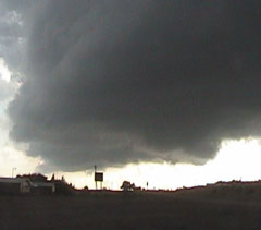
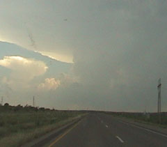
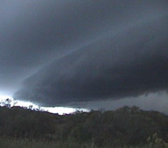
6/12 Dickens, TX Tornado Began the day by running into several chasers in Matador, TX including the TTU mesonet team. I caught a tornado just east of Dickens, TX. After this storm died...I blasted south towards Hamlin to view the decaying stages of a second supercell. Big thanks to Blake Michaleski and Lee Robertson for nowcasting. |
|
5/31 Permian Basin/Concho Valley Supercells I got off of work around 3pm and headed west to target Big Spring, TX. My target was a bit too far west as the storm developed directly over my head. So, from the get go I was behind the storm. Decided to follow behind it on back roads rather than making a long trip around it due to the fact that initiation wasn't until near 00Z and going around would have put me back on the updraft close to dark. Nonetheless...saw some great structure during daylight and caught the storm back in SJT for some small hail. Thanks to Blake Michaleski for nowcasting. |
|
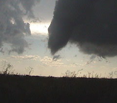
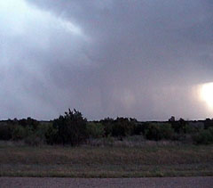
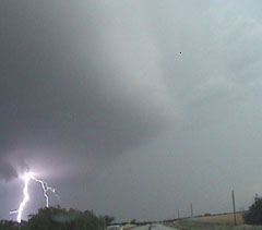
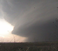
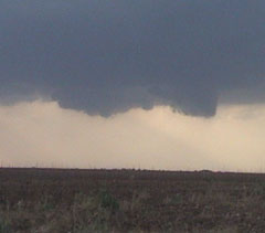
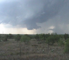
5/13 North-Central Texas Blake Michaleski, Cory Bovard and I caught a nice tornado east of Truscott, TX in Knox Co. Scary moment as the storm took an unexpected turn while we were repositioning and the RFD core over took us, blasting us with winds estimated at over 100mph. Lost a rear side window on the Blazer in the RFD. Amazing structure with this storm. |
|
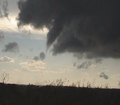
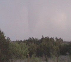
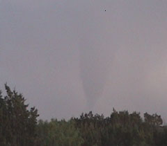
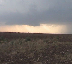
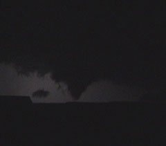
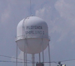
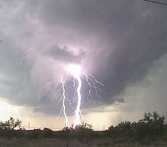
5/12 Panhandle Supercells and Tornadoes Blake Michaleski, Cory Bovard and I caught 3 tornados on the southern group of supercells near and just east of LUB. The first one near Robertson was at sundown but contrast was so bad it was hard to see with our eyes and it barely even showed on film. The other two were at night, the first north of Lorenzo and was breif and then several funnels and a nice cone late north east of Crosbyton. |
|
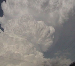
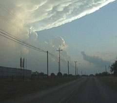
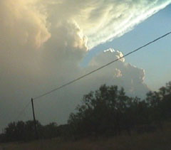
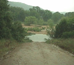
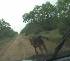
5/09 Hill Country Texas Supercells Blake Michaleski, Cory Bovard, and I targeted the dryline from BWD to AQO. We had a late start on the day due to equipment problems. The first storm initiated just south of AQO around 21Z. This put us a little behind this storm, however, new convection quickly fired in moist, unstable airmass coupled with remnant surface boundaries. We drove through Llano, TX encountering a little pea sized hail and decided to take a south road just east of the town. Once south, we heard reports of softball sized hail 8 miles west of LLano. Then came the decision to take a Co. road option west. This took us on a great field trip to observe some Hill Country livestock. After about 20 minutes of Co roads, we came to a stop due to a creek washing over the road with about 2 feet of water across the pass. We decided to turn around and don't drown at that point and took the 20 minute trip back up the Co roads. So, back in LLano, which wasn't too bad considering the storms were nearly stationary, we took a paved road southwest out of the town. This time law enforcement stopped us to turn around don't drown as another creek was across the paved road. So, back into LLano we tried to cross the creek a little further west. But again the water was across the road...about mid shin high. At this point, the sun was getting low allowing for great structure shots of the storm. We ended the day just east of Mason, TX as the storms began dissipating with the loss of daytime heating.
|
|
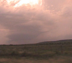
5/08 West Central Texas Supercells Blake Michaleski, Cory Bovard and I started the day in SJT since I had to work until 2pm. We got on a storm just east of SJT and it took on a rather impressive supercellular structure. Eventually it went outflow dominant at the surface and looked like it was falling a part. As we were heading down the road to position back ahead of it some, we had a total loss of power, as in the engine wouldn't run. After sitting there letting the storm overtake us, Blake hopped out only to see a rainbow. Not the kind in the sky but the kind when gasoline floats over water. I turned the key to the run position and fuel shot out from underneath the vehicle. THE FUEL LINE FELL OFF THE TRUCK!!!! It came disconnected at the filter. Blake hopped under the rig and snapped it back on as it was just one of those snap on connectors with the locking tabs. His theory is a rock from the gravel road we were on flew up and hit the tab, releasing the line. So on the road again we encounter about quarter sized hail and punch back out ahead of the storm in the forward flank. At this time a cell merger had taken place and our storm, now in Mason county TX, was a big fat honking HP beast. By this time we were all up in the hill country and visibility was poor along with the bad road networks. We stopped in Fredericksburg and let the storm over take us again and then headed home. |
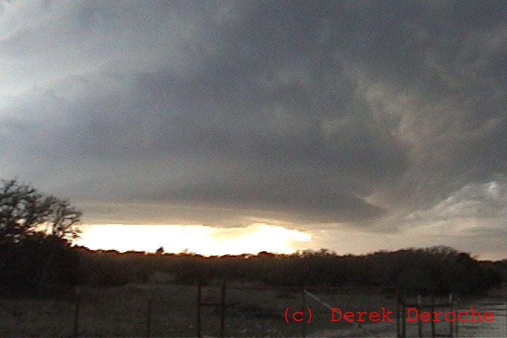 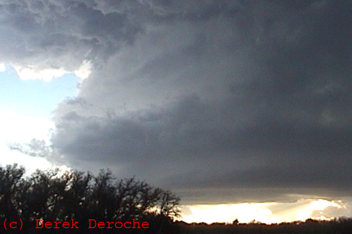 |
3/25 Kimble and Mason County Texas Supercells A local chase day as I left work at 4pm targeting just north of Junction, TX. The day was characterized by a stationary boundary....Full Chase Account Here |